
Introducing mapsnap: Automated Georeferencing for Historic Sanborn Insurance Maps
Over the past few months I’ve been working on mapsnap, a program to automatically georeference old insurance maps. This post explains why these maps are interesting, how mapsnap works, and why this is worth doing.
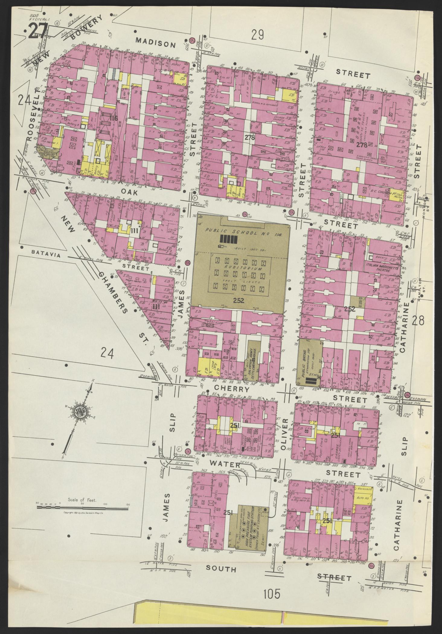
The article introduces mapsnap, a program designed to automatically georeference historic Sanborn Insurance Maps, making them more accessible and usable for research and historical analysis.
What happened
The author developed mapsnap, an automated system to georeference Sanborn Insurance Maps by using OCR to detect street labels and RANSAC to find the best alignment with modern maps.
Why it matters
Georeferencing historic maps allows for better integration with modern geospatial data, aiding in historical research, urban planning, and understanding past urban development.
- Automated georeferencing tools like mapsnap can significantly enhance the usability of historic maps.
- OCR and RANSAC are effective techniques for aligning historical data with modern geospatial systems.
- Historic Sanborn maps offer valuable insights into urban history and development.
- The project highlights the importance of combining traditional data with modern AI techniques.
- Challenges in georeferencing include ambiguous street names and changes in urban infrastructure over time.
The bigger picture
The automation of georeferencing Sanborn maps reduces the manual effort required, making historical urban data more accessible and usable for researchers and professionals.
mapsnap provides an automated solution for georeferencing Sanborn Insurance Maps, leveraging OCR and RANSAC to align historic data with modern maps, thus enabling easier access to valuable historical urban information.
Technical details
- OCR (Optical Character Recognition) using EasyOCR to detect street labels.
- RANSAC (Random Sample Consensus) algorithm to filter outliers and find the best georeference fit.
- Extrapolation of street labels to identify intersections.
- Use of OpenStreetMap (OSM) for latitude and longitude data of intersections.
- Vocabulary-based filtering to improve street name recognition.
FAQ
What are Sanborn Insurance Maps?
Sanborn Insurance Maps are detailed, block-by-block maps of U.S. cities created from 1870-1960, originally used for insurance assessments but now valued for historical urban data.
How does mapsnap work?
mapsnap uses OCR to detect street labels, extrapolates intersections, and applies the RANSAC algorithm to find the best georeference fit with modern maps.
What are the challenges in georeferencing Sanborn maps?
Challenges include ambiguous street names, curved streets, renamed or changed streets, and areas with few streets, which can affect the accuracy of automated georeferencing.
Why is georeferencing important for historic maps?
Georeferencing aligns historic maps with modern geospatial data, enabling better integration for research, urban planning, and historical analysis.
Where can I access georeferenced Sanborn maps?
Georeferenced maps can be browsed at mapsnap.org.
This summary and analysis were generated with AI from the original article and may contain errors. Read the original for the full story.
Read the full story
Originally published by Lobsters on Oct 7, 2026.
Comments
Sign in to join the discussion.